Our Service to You
Stewardship That Lasts
Legacy Conservation Group helps landowners turn good intentions into measurable conservation impact. We design custom land stewardship and habitat management plans that align with NRCS standards and local ecology. From pine stand restoration and invasive species control to wildlife habitat enhancement and long-term maintenance strategies, our work blends field-based expertise with practical, actionable planning.
Each project begins with on-site evaluation and mapping, followed by clear recommendations that make conservation achievable — not abstract. Our goal is simple: healthy land, thriving wildlife, and lasting legacy.
Consulting
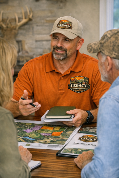
Conservation Consulting With Real‑World Impact
Legacy Conservation Group provides practical, on‑site consulting for landowners who want healthier forests, stronger wildlife habitat, and a clear plan for managing their property. Every service is built on field experience, ecological understanding, and a commitment to stewardship that lasts.
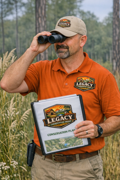
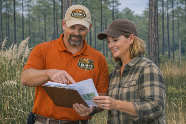
Property Walk & Habitat Assessment
A thorough, boots‑on‑the‑ground evaluation of your land.
I walk the property with you, identify key features, and document the condition of your pine stands, understory, wildlife habitat, and problem areas. You’ll gain a clear understanding of what’s working, what needs attention, and what opportunities exist for improvement.
Includes:
- Stand condition and habitat quality review
- Invasive species identification
- Soil, slope, and hydrology considerations
- Immediate recommendations you can act on
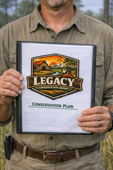
Custom Conservation & Stewardship Plans
A detailed, science‑based plan tailored to your goals and your land.
These plans follow NRCS standards and provide a clear roadmap for restoring, improving, and maintaining your property over time.
Plans may include:
- Pine stand restoration and thinning guidance
- Prescribed fire readiness and alternatives
- Wildlife habitat enhancement strategies
- Seasonal management timelines
- Long‑term stewardship objectives
- GIS maps and treatment areas
Your plan is written in plain language — no jargon, no guesswork — so you can move forward with confidence
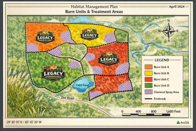
GIS Mapping & Spatial Analysis
Professional mapping that brings clarity to your land.
I create clean, accurate maps that help you visualize stand boundaries, treatment zones, access routes, water features, and habitat types.
Mapping services include:
- Parcel and boundary mapping
- Stand delineation
- Treatment and practice maps
- Before/after condition comparisons
- Landowner‑ready map packages
NRCS Program Support
If you’re pursuing NRCS cost‑share programs, I help align your goals with program requirements and ensure your plan is structured in a way that supports your application.
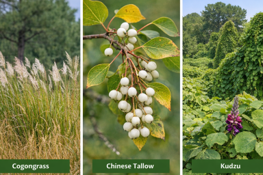
Invasive Species Identification & Control Strategie
Early detection and targeted action save time, money, and habitat.
I identify invasive plants on your property and outline effective, realistic control methods tailored to your land and your capacity.